Stafford Borough Council
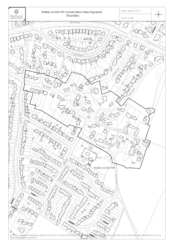
Conservation area: Walton-on-the-Hill 18
Legend
- Stafford Borough Council boundary
- Conservation areas
Walton-on-the-Hill 18
- geometry
-
MULTIPOLYGON (((-2.065453 52.787180,-2.065557 52.787059,-2.065715... - reference
- 18
- designation-date
- 1977-03-03
- documentation-url
- https://www.staffordbc.gov.uk/conservation-areas-list
- end-date
- entry-date
- 2017-03-06
- name
- Walton-on-the-Hill
- notes
- start-date
- 1977-03-03
- point
-
POINT (-2.064328 52.78585) - GeoX
- GeoY
- legislation
- organisation